Floating Lab Field Trip
Oceanography students were blessed with a picture perfect day for their field trip with the
UNH Marine Docents Floating Lab Program on October 4, 2013. This program took place on a fishing boat rented from
Eastman's Docks in Seabrook, NH and consisted of five separate lab activities, each about 25 minutes long. The five labs were:
- Plankton sampling
- Charting a position
- Benthic organisms
- Water sampling
- Georges Bank Fish
Students were grouped into five groups and rotated through the stations. Each station had two marine science docents, so the student-to-teacher ratio was no more than 1:3! This was a wonderful opportunity to get some authentic learning for high school students. We also took advantage of a sandy beach lesson after lunch. Each station is briefly described below.
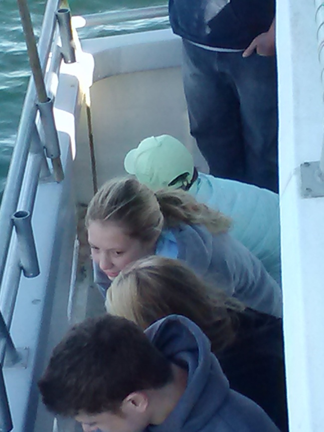
Trawling For Benthics
Before any of the activities got underway, we trawled for
benthic organisms and the students helped pull up the catch.
 |
| A model of the trawling net is used to explain its operation |
 |
| Many hands make light work. |
 |
| The trawl line dragging behind the boat |
 |
| Students line up and grab a piece of the trawl line rope to pull it up. |
Bottom trawling is a benthic sampling technique that uses a net dragged along the bottom of the water body to collect organisms living there, for further study. The device used in this program is shown in model form in the image below. If has floats on the top of the net and weights on the bottom of the net to keep the net as open as possible. For purposes of scientific study, it provides a "grab" sample of a small area and facilitate habitat mapping studies. Since trawls are destructive in nature, they are not to be used in fragile habitats.
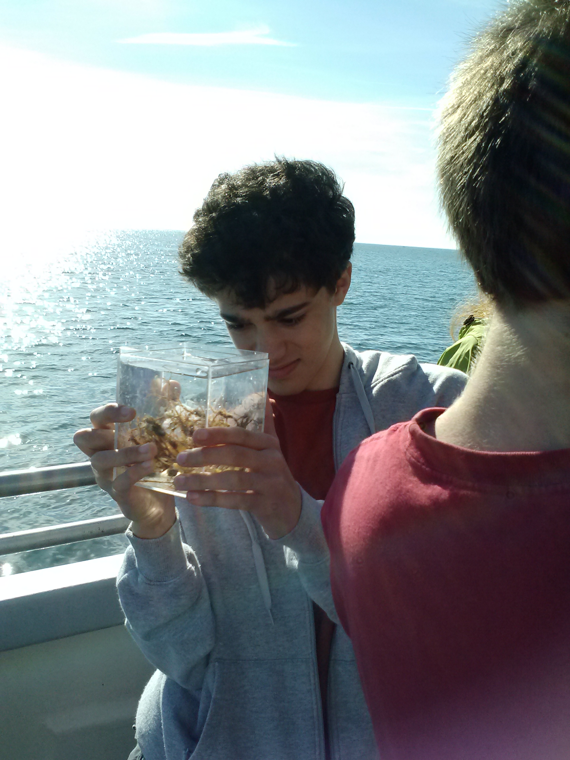
Plankton Catch
Students used a standard plankton net - and I forget the size mesh - for taking a plankton sample. The critters were then rinsed down the mesh and collected in a box, where students could take a sample for viewing. The viewing container, I believe this is a
DiscoveryScope, is a little clear rectangular box that fits together. This viewing box then fits onto a frame with a magnifying glass to look through. I could not get any pictures through the view box but some of the students were able to.
 |
| Working a plankton sampling net |
 |
| Stunning students sampling plankton |
 |
| Viewing box to see the plankton collected |
 |
| Learning how to use a parallel ruler |
Charting Your Position
At this station students determined their location in Hampton Harbor using a portion of the marine chart and parallel rulers. We had tried a similar activity in class, but did not have any parallel rulers, and this - being on the water bobbing around and looking for water towers and high tide lines - gave a more honest representation of how to plot your location. The students also had real compasses, rather than their iPhone compass, which further improved the activity.
Benthic Organisms
The best way to describe what was pulled from the bottom is to show you the pictures.
 |
| Tough guy crab |
 |
| Baby lobsters |
 |
| Sea squirt |
 |
| Baby mussels and tunicates |
 |
| Red algae |
 |
| Front box: barnacles feeding |
 |
| Sand dollar, baby flounder, and red algae |
 |
| Adult female lobster with thousands of eggs on swimmerets |
The lobster in this picture was quite large with an impressive number of eggs on the swimmerets. I wish I had gotten a better picture.
 |
| Two baby lobsters with a Jonas crab |
Water Sampling
 |
| Students setting up a Van Dorn bottle, horizontal water sampler, to take water sample. |
 |
| Students take water samples at 5m depth |
 Georges Bank Fish
 |
| Thinking about what fish use Georges Bank, what they eat, where they live, and their abundance. |
Afternoon Sandy Beach Program
We had a 45 min break for lunch (yay! beach pizza from
Tripoli's!) and then one last activity on the beach: How do beaches form? Students examined and compared high, mid, and low-tide sands as well as the wrack line, and made nifty little booklets about what they uncovered.

 Student Assignment
Students who went on this field trip are to blog their learning, choosing from one of the questions below or creating their own:
- How was your ocean literacy changed?
- What is one thing you learned today?
- Choosing just one of the floating lab stations, what value did you get from the station?
- How did this field trip help you understand marine science?
- How did the field trip illustrate methods used by scientists in the real marine science investigations?
- What do you understand better now, as a result of the learning stations?
All statements must be supported with evidence (examples), and have follow-up from additional sources (links). The usual two paragraph minimum with a related picture applies. The pictures Ms. Goodrich took are
here.
Kudos
It was a good day. The weather was spectacular. The students were engaged in real, honest-to-goodness science practices. And the staff of both Eastman's and the UNH team were great.
Thanks goes out to
Dari Ward at UNH for organizing this wonderful ocean literacy program. The docents on this field trip were extremely professional, knowledgeable, friendly and experienced. They enhanced the program considerably with these qualities. The program itself is funded through a
New Hampshire Sea Grant.


 Bottom trawling is a benthic sampling technique that uses a net dragged along the bottom of the water body to collect organisms living there, for further study. The device used in this program is shown in model form in the image below. If has floats on the top of the net and weights on the bottom of the net to keep the net as open as possible. For purposes of scientific study, it provides a "grab" sample of a small area and facilitate habitat mapping studies. Since trawls are destructive in nature, they are not to be used in fragile habitats.


1 comment:
Awesome! Inspiring! :))
Post a Comment